Precipitation amount from IMERG
Topics
- Access
- Description
- Parameters
- Coverage, spatial and temporal resolution
- Data quality
- Contact person
- References
- Data citation and License
Access
RESTRICTED: This link to the data set is only available for a restricted user group. The data set is only accessible in CEN/MPI net or accessible from external nets with a customer account. Please contact ICDC if you would like to access this data from outside the network.
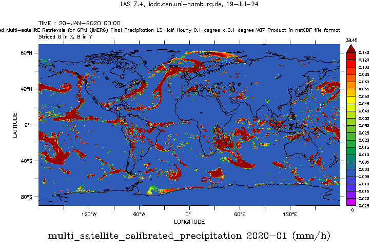
- View IMERG data from 2020 on at LAS
- Access IMERG data from 2020 on via OPeNDAP
- Data access via file system: /data/icdc/atmosphere/imerg
Description
IMERG is the acronym for "Integrated Multi-satellitE Retrievals for GPM" - here used to generate the Version V07 Level-3 half-hourly precipitation amount data set: GPM_3IMERGHH.07.
Precipitation estimates from the various precipitation-relevant satellite passive microwave (PMW) sensors comprising the GPM constellation are computed using the Goddard Profiling Algorithm (GPROF V07), then gridded, intercalibrated to the GPM Combined Ku Radar-Radiometer Algorithm (CORRA V07) product, and merged into half-hourly 0.1°x0.1° (roughly 10x10 km) fields. For detailed information we refer to the various technical documents found in the references section of this page.
Last update of data set at ICDC: February 5, 2026
Parameters
| Name | Unit |
|---|---|
| amount of precipitation | mm / hour |
| fraction of liquid precipitation | % |
| quality index | - |
| Random retrieval error | mm / hour |
Coverage, spatial and temporal resolution
Period and temporal resolution:
- 2000-06-01 to 2025-08-31
- every half hour (48 / day)
Coverage and spatial resolution:
- Global
- Spatial resolution: 0.1 ° x 0.1 °, Cartesian grid
- Longitude: -179.95 ° E to 179.95 ° E
- Geographic latitude: -89.95 ° N to 89.95 ° N
- Dimension: 3600 columns x 1800 rows
- Height: Terrain-Following
Format:
- NetCDF
Data quality
The data set offered here contains two measures for the uncertainty. One is a quality flag which essentially indicates the consistency of the precipitation values with one another (over time and space and between the input data) , see documentation about the quality index in the references. The other is random errors in the final product calibrated using precipitation station data (see the "GES DISC Dataset: GPM IMERG Final Precipitation" in references). In general we refer the the various documents found in the references section of this page; please pay particular not to the imerg-v07-release-notes document.
Contact
G. Huffman et al.
NASA Global Precipitation Measurement Mission Team
Goddard Earth Sciences Data and Information Services Center (GES DISC), Greenbelt, MD, U.S.
email: gsfc-help-disc (at) lists.nasa.govStefan Kern
University of Hamburg, Department of Earth System Sciences
email: stefan.kern (at) uni-hamburg.de
References
Literature:
- IMERG V07 Release Notes (pdf, not barrier free)
- IMERG V07 Algorithm Theoretical Basis Document (ATBD) (pdf, not barrier free)
- IMERG V07 combined algorithm ATBD (pdf, not barrier free)
- IMERG V07 final technical documentation (pdf, not barrier free)
- IMERG V07 GPROF release notes (pdf, not barrier free)
- Tan, J., et al., IMERG V06: Changes to the Morphing Algorithm. J. Atmos. Ocean. Technol., 36(12), 2471-2482, 2019, https://doi.org/10.1175/JTECH-D-19-0114.1.
- Joyce, R. J., et al., Kalman Filter Based CMORPH, J. Hydrometeor., 12(6), 1547-1563, 2011, https://doi.org/10.1175/JHM-D-11-022.1.
- Hong, Y., et al., Precipitation Estimation from Remotely Sensed Imagery Using an Artificial Neural Network Cloud Classification System, J. Appl. Meteorol., 43(12), 1834-1853, 2004, https://doi.org/10.1175/JAM2173.1.
- Huffman, G. J., et al., The TRMM Multi-satellite Precipitation Analysis: Quasi-Global, Multi-Year, Combined-Sensor Precipitation Estimates at Fine Scale, J. Hydrometeor., 8(1), 38-55, 2007, https://doi.org/10.1175/JHM560.1
- Behrangi, A., and Y. Wen, On the spatial and temporal sampling erors of remotely sensed precipitation products, Remote Sensing, 9(11), 1127, 2017, https://doi.org/10.3390/rs09111127.
- Tang, G., et al., Have satellite precipitation products improved over the last two decades - A comprehensive comparison of GPM IMERG with nine satellite and reanalysis data sets, Rem. Sens. Environ., 240, 111697, 2020, https://doi.org/10.1016/j.rse.2020.111697.
- Navarro, A., et al., Assessment of IMERG precipitation estimates over Europe, Remote Sensing, 11(21), 2470, 2019, https://doi.org/10.3390/rs11212470.
Websites:
- GES DISC Dataset: GPM IMERG Final Precipitation L3 Half Hourly 0.1 degree x 0.1 degree V07 (GPM_3IMERGHH), https://disc.gsfc.nasa.gov/datasets/GPM_3IMERGHH_07/summary
Data citation, License, and Acknowledgments
Please cite the data as follows:
Huffman, G.J., E.F. Stocker, D.T. Bolvin, E.J. Nelkin, Jackson Tan (2026), GPM IMERG Final Precipitation L3 Half Hourly 0.1 degree x 0.1 degree V07, Greenbelt, MD, Goddard Earth Sciences Data and Information Services Center (GES DISC), https://doi.org/10.5067/GPM/IMERG/3B-HH/07 [last access: January 29, 2026], distributed in netCDF file format by ICDC, CEN, University of Hamburg.
and with the following acknowledgments:
Thanks to ICDC, CEN, University of Hamburg for data support.
License
Please see GES DISC dataset website for license informations.